If you have questions about purchasing a license call 1-800-5GO-HUNT.
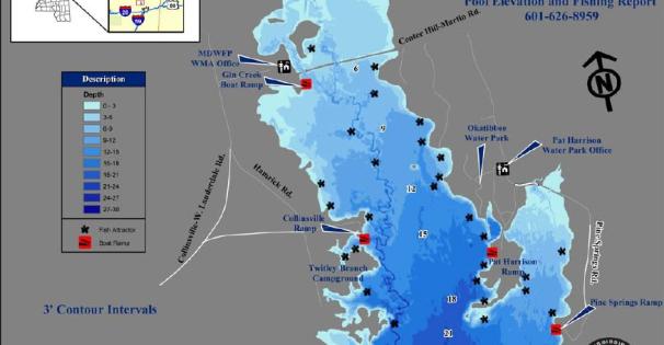
*Okatibbee Reservoir is operated by the U.S. Army Corps of Engineers (COE). The MDWFP Fisheries Bureau manages the lake's fisheries resources and provides weekly fishing reports. Okatibbee Reservoir is a 3,500-acre impoundment, that was built in 1968 to reduce flooding along Okatibbee Creek and the Chickasawhay River.
For more information on this lake's fees, permits, rules and regulations, and amenities visit the Okatibee Lake page at the U.S. Army Corps of Engineers website.
For daily temperature, water level, and release you can call the automated report at (601) 626-8431.
| Species | Detail |
|---|---|
| Largemouth Bass | Bass fishing has been good. Target bass on flats and in the stumps. Creek channels near emergent vegetation are also excellent places to get try. Try fishing crankbaits or spinner baits. Fishing slower using soft plastics on either Texas or Carolina rigs may be effective as follow up baits. |
| Crappie | Crappie fishing has been good. Look for crappie to be making runs for the grass, the rocks along the dam and around millionaires point. Try to target schools of fish using minnows or jigs. |
| Bream | Bream should be holding in 2 and 6 ft. of water around brush piles or other types of natural structure. Try using live baits such as crickets or worms on the bottom or near deep structure. |
| Catfish | Catfish can be targeted with trot lines and jugs out in open water. They will most likely still be holding out deep. Tightlining on the bottom with liver, worms or blood baits may be effective with the colder weather. |
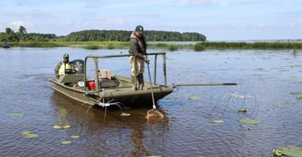
GPS locations of structure that was added Feb. of 2016.
N 32.50402 W 88.79859 N 32.50669 W 88.79920
N 32.50374 W 88.79904 N 32.50731 W 88.79954
N 32.50388 W 88.79893 N 32.50788 W 88.79963
N 32.50162 W 88.79910 N 32.50779 W 88.79923
N 32.50196 W 88.79867 N 32.50769 W 88.79933
N 32.50220 W 88.79879 N 32.49845 W 88.80088
N 32.50301 W 88.79099 N 32.49870 W 88.80081
N 32.50308 W 88.79082 N 32.49809 W 88.80085
N 32.50379 W 88.79163 N 32.49726 W 88.80051
N 32.49809 W 88.80085 N 32.49684 W 88.80071
N 32.49736 W 88.80036 N 32.49703 W 88.80061
GPS Locations of structure that was added Feb 2017
N 32.50385 W 88.79848 N 32.50542 W 88.79883
N 32.50688 W 88.79911 N 32.50491 W 88.79847
N 32.50631 W 88.79948 N 32.50362 W 88.79835
N 32.50583 W 88.79966 N 32.50378 W 88.79896
N 32.50583 W 88.79906 N 32.50326 W 88.79865
N 32.50564 W 88.79934 N 32.50301 W 88.79849
N 32.50534 W 88.79861
Find and learn more about *Okatibbee Reservoir...